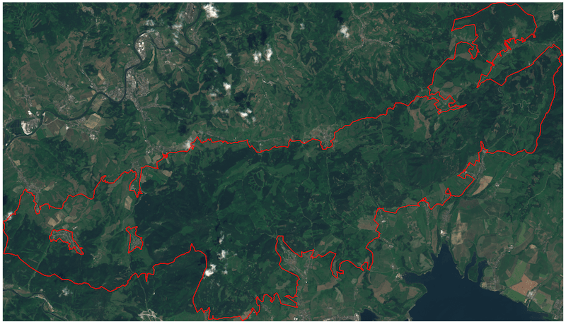
Study area
In 1992, the EU established a network of threatened and important areas in terms of both habitats and species, known as “Natura 2000”. The Choč Mountains area was chosen for a case study to present some of the Ström abilities.
Forest Intelligence is a set of different modern approaches such as usage Satellite Products & Artificial Intelligence technology for the Management of Forest Inventory. Our analyses are used for regular monitoring and mapping of forest drought, insects, forest health, forest fires, and deforestation.
In 1992, the EU established a network of threatened and important areas in terms of both habitats and species, known as “Natura 2000”. The Choč Mountains area was chosen for a case study to present some of the Ström abilities.
We are calculating several vegetation indices such as NDVI, EVI, TGI, NDWI, NBRI to monitor current forest health. These indicators will be used also to provide early detection of possible forest threats.
True color
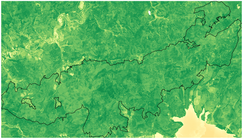 NDVI
NDVI

The Normalized Difference Vegetation Index (NDVI) is a numerical indicator associated with vegetation content. High NDVI values correspond to areas with denser and healthier vegetation. It also allows detect abnormal changes in the growth process.
NDVI values are defined from -1.0 to 1.0 with corresponded color map, where each color represents to a certain range of values. The red-orange-yellow tints indicate bare soil, water bodies or dead/sparse vegetation. All shades of green are a sign of normal to dense vegetation cover.
Advanced Vegetation Index (AVI) is one of the indices that examine the characteristics of the vegetation chlorophyll. Compared to NDVI, the AVI reacts more sensitively to vegetation quantity and is able to highlight subtle differences in canopy density.
The value AVI for a given pixel ranges from minus one (-1) to plus one (+1). No green leaves gives a value close to zero. A zero means no vegetation and close to one indicate the highest possible density of green leaves and negative values mainly represent water and other non vegetated surface.
True color
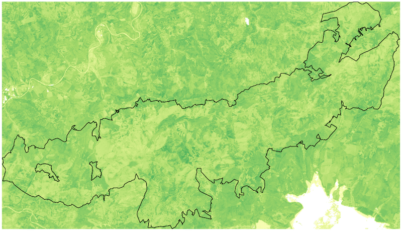 AVI
AVI

Thanks to the frequent and regular Earth Observation data from the satellites we are able to monitor forest changes in time and detect tree loss.
According to Global Forest Change analysis the forest loss in the study area was 1708Ha between years 2000 and 2018. Global Forest Change is result of University of Maryland's effort of monitoring global forest ecosystem. Ström is using this dataset to improve and validate our AI models and algorithms.
Natura2000
 Deforested areas
True color
Deforested areas
True color
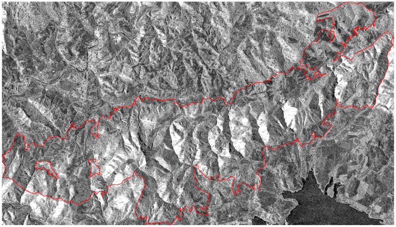 SAR
SAR
Synthetic-aperture radar (SAR) is providing continuous all-weather, day-and-night imagery. With analysis of changes between two or more SAR images taken at different times we are able to detect land changed (such as deforestation).
You can stop by our office for a cup of coffee and just use the contact form below for any questions and inquiries.
Copyright © ![]() Zaitra s.r.o
2020
Zaitra s.r.o
2020